It became another hot summer day and I decided to move back to Skrova Island. I do not only prefer the quite and charming island over buzzling Svolvær but also wanted to get into the pool position for my potential plans for the coming week, Trollfjorden.
Svolvær is only a 30min ferry ride away and I have already greeted the Captain today, while giving the ferry courtesy right of way on the final approach into the harbour.
Weather forecasts provide initial indications, that the summer might come to an end soon.
I would not have been on the road today, but the change in Susan’s travel routing to get home made it possible. After an early morning walk to the airport, I was curious to hit the road.
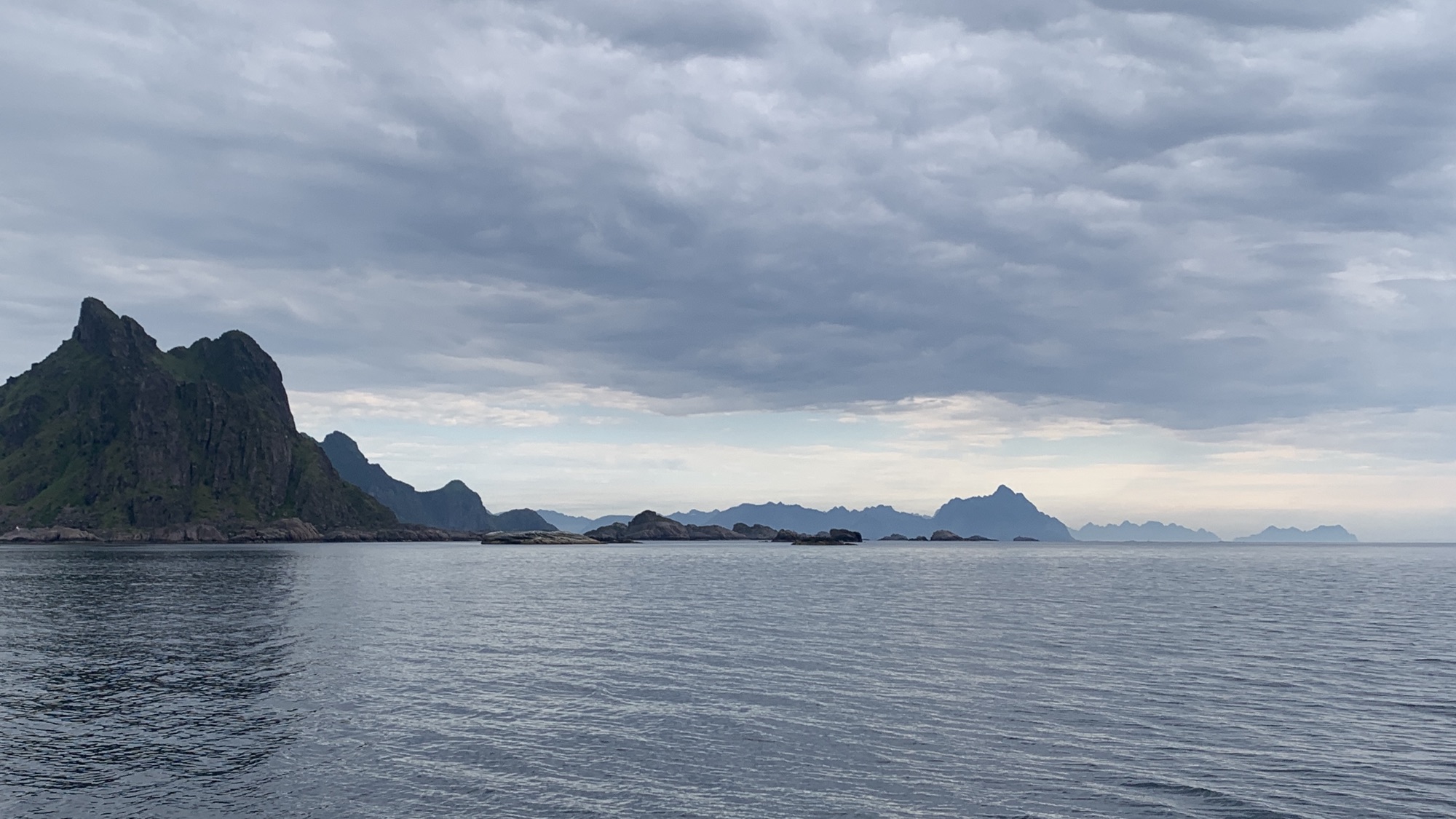
The weather pattern – sun in the south and clouds in the north of the Lofoten Archipelago – made it another colourful ride, although I would have preferred to see a little bit less overcasted skies along the northern shores of Austvågøya. A complain on a very high level. It was a very good ride.
I have decided to stay a second night in Svolvær, no rush.
The weather forecast invited for another beach day. Well, half day, as there was some boat work on the list as well again and the sky cleared only up just after lunch time. There was then still no rush as the days are still long although slowly you feel, that it is changing. We try to get most out of it.
We took the dinghy through a labyrinth of skerries to get to the island of Sandøya and its picturesque beach with the massive rock formation of Litlmolla in the background. Our mussel collection got bigger and bigger.
Finally it was a clear cut taking weather forecasts also into the equation. Stay on Skrova Island, no reason to rush! It became a day with some boat work and a short hike to further explore this beautiful island. The beaches were our target despite the low hanging clouds.
We left Svolvær in the early morning hours as our program for the planned one night stopover at Skrova Island was packed and included one bike ride and one hike. Sitting here now in the evening ours, I am not sure we make it to leave tomorrow, the island is simply to gorgeous.
Our cockpit view captures it all: The traditional and modern world in marvellous nature.
After cycling every inch on the island, including the gravel section to Hattvika Beach we clocked just below 10km. It gave us a good overview about the size and vibe on the island, known as the cultural hotspot of the Lofoten. The photo exhibition arranged within the road tunnel under perfect lighting conditions is one of the proof.
Hard to believe, a tunnel on this tiny island.
After some rest, we kicked-off the hike to Skrova’s mountain viewpoint at 259m above sea level. After a relatively short but rough hike we took plenty of time to absorb this breathtaking view – without doubt, the best on the Lofoten so far.
The best view we had so far here in the Lofoten. Skrova - The Photo Island.
With less than 200 locals permanently living on this amazing island, which is only a 30 minutes ferry ride away from tourist hotspot Svolvær, and now at peak holiday season in Norway, I remain puzzled how peaceful this spot comes across.
Tired but happy we will see, if we can leave this place behind already tomorrow and move on as planned or not. I have some doubts!
Debatable, if this church presents itself more picturesque from outside at low or at high tide.
After spotting another track on Komoot around Svolvær, I was back in the saddle around 10am to check it out. Additionally motivated from the fact, that the ride will pass along Vågan Church in Kabelvåg, a unique heritage building, which we missed last time. Also had another check on Kabelvåg downtown before hitting the gravel.
Wild, ~500m catch & carry was needed.
The gravel became a trial and my Chiru X-Root got quickly to its limit. Nevertheless I got through and enjoyed another excursion into this beautiful nature.
We have now taken berth under the Svolværgeita in the Vågan Båt- og Sjøfiskeforening (Vågan Boat and Sea Fishing Association), the local boat club in Svolvær. While the short passage was uneventful, the approach to the marina was at least exciting.
A short sniff tour took us around to some nearby beautiful nature reserve before passing through downtown Svolvær with its promenade and city marina. Svolvær is considered to be Lofoten’s unofficial capital.
I consider Gimsøya as a separate Lofoten island not only because its linked by via two bridges with the neighbouring islands but also due to its size and vegetation. It’s debatable but the latter one is clearly different to what we have seen up to know.
Crossing the Gimsøystraumen under windy conditions straight into the clouds.
In any case it was a nice supplemental ride added to the Lofoten portfolio so far.
We visited nearby Kabelvåg today and got into some drizzling skies on the way back. Still pretty warm despite the hiding sun. A freshly homemade nutcake à la Kalle awaited us back at our tiny floating home followed by a well deserved solid nap. Kassler with Sauerkraut is on the menu for dinner.
A bit of motor sailing took us under an overcasted sky further along the Lofoten mountain panorama. The colour scheme changed from former base bluish over the recent days to pastel greyish. Upon arrival in Henningsvær it had both elements. Our mooring is right in the city centre, busy and safe as shown on the photo.
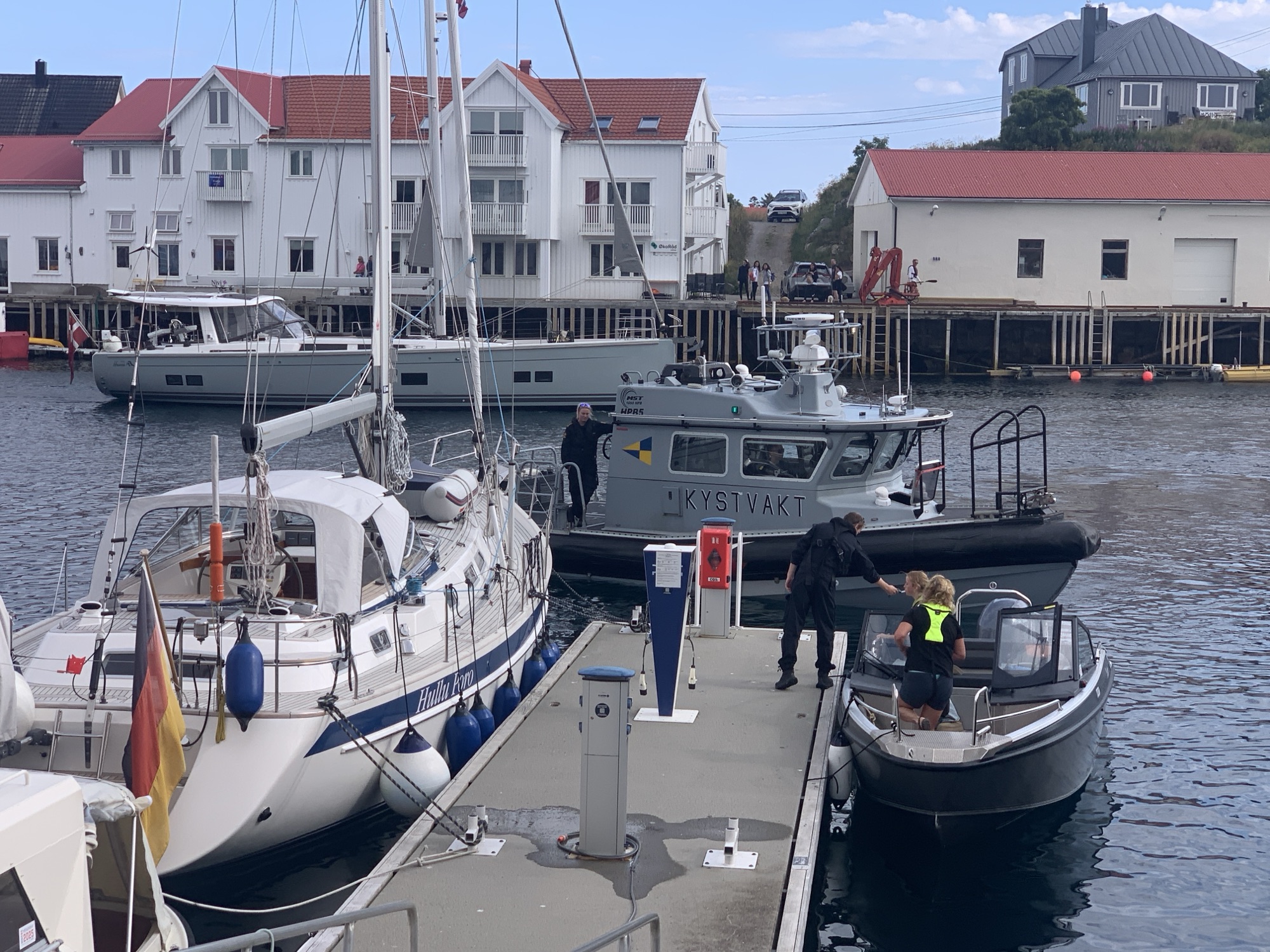
A routine check, friendly and professional.
Susan called ORCAS as she spotted them first. It was at a distance but the fins clearly visible through the binoculars. We could even determine male and female from the difference in shape. It was a big pod slightly split but most likely being one group. There shall be more whales in the Vestfjorden later in the year.
We also saw a big dolphin crossing our bowline, which became less spectacular under these circumstances.
Time to explore Henningsvær and its surroundings over the next couple of days.