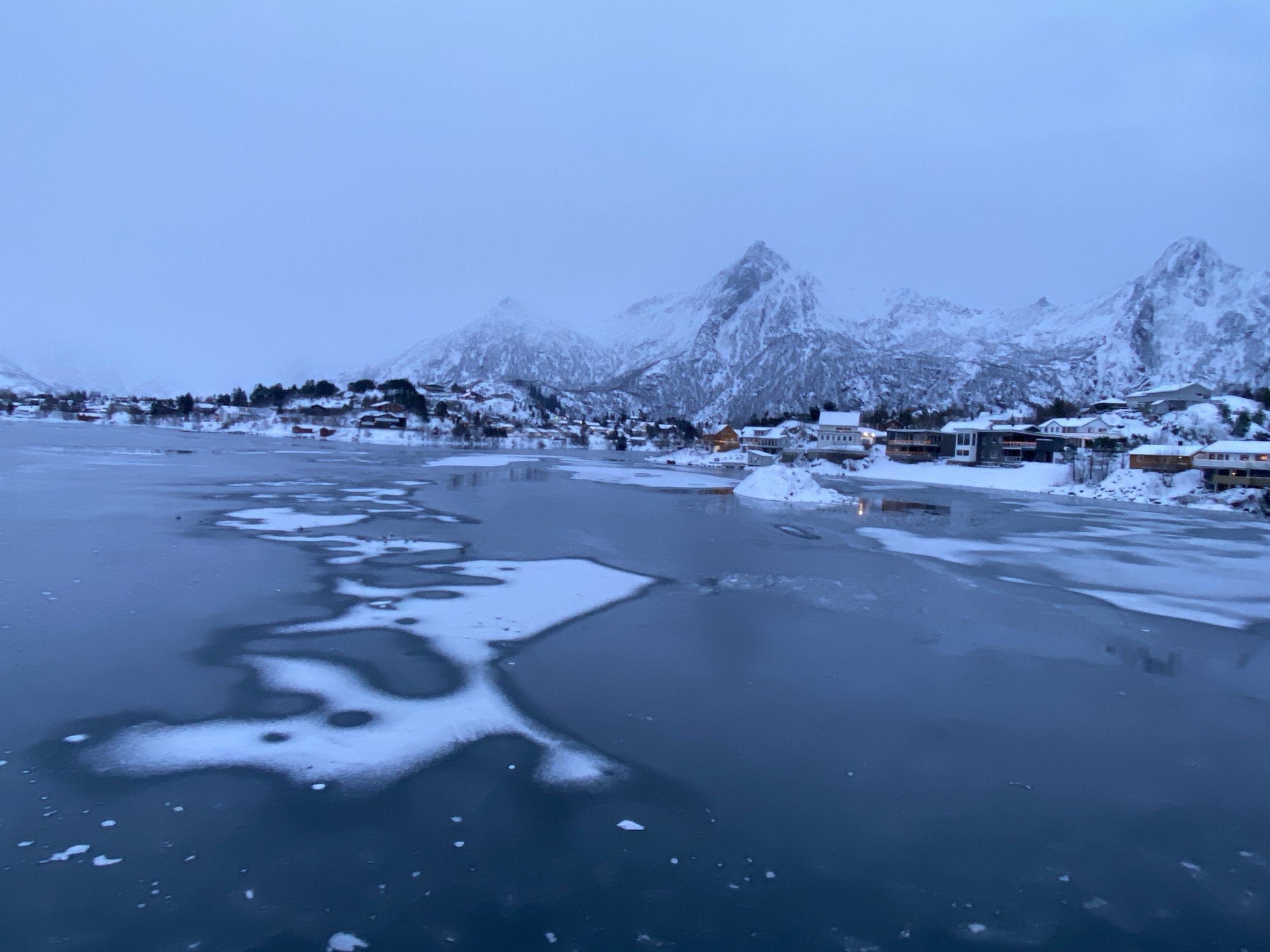
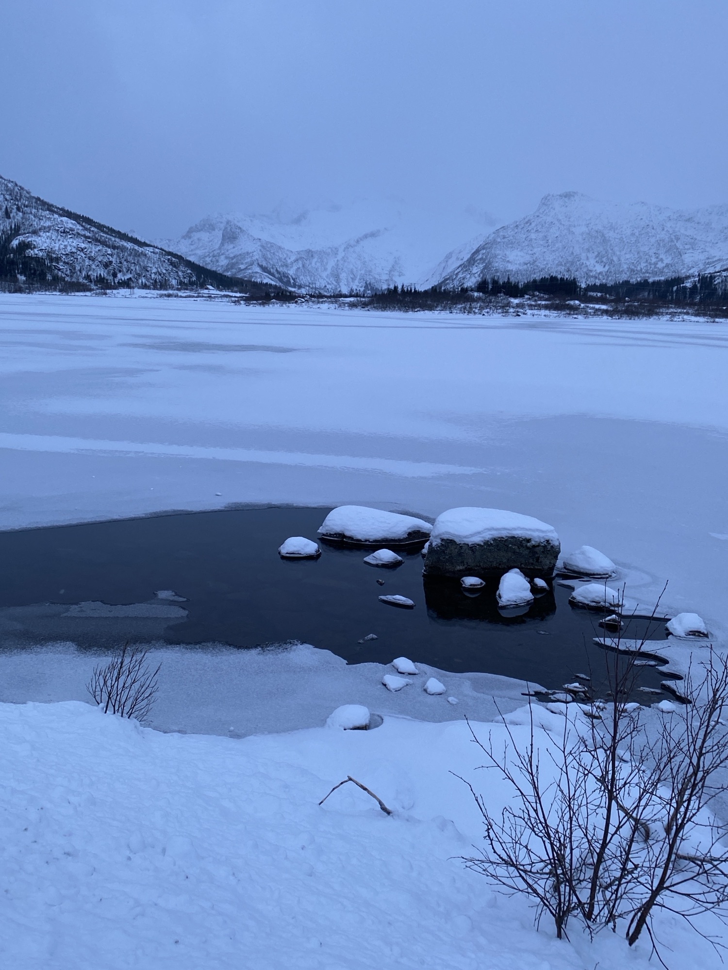
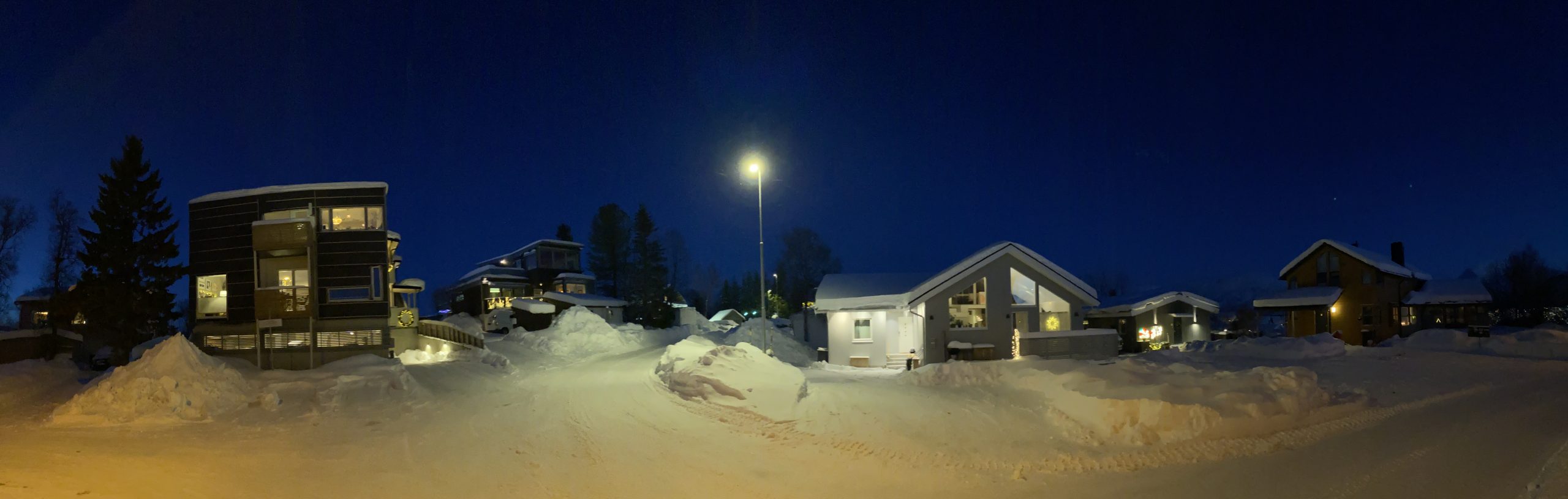
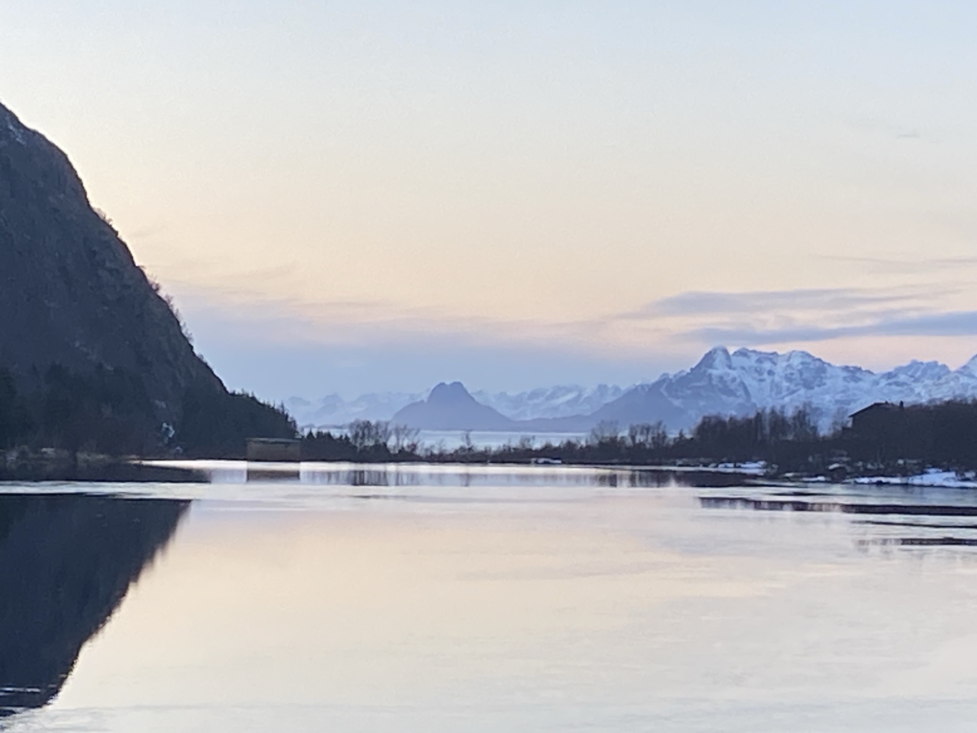
The ongoing freezing temperatures keep shaping the winter scenery with lakes starting to build some ice formations. Sweetwater “vatnets”, as expected, ahead of the saltwater fjords.
While the X-country skiing tracks are prepared the works on the downhill skiing lift area are still underway, expected to open soon.
We will be out exploring this winter wonderland further going forward.
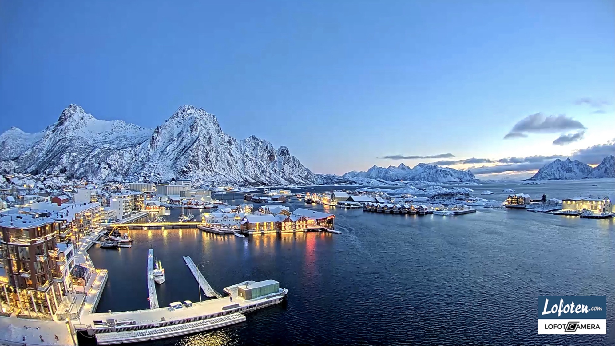
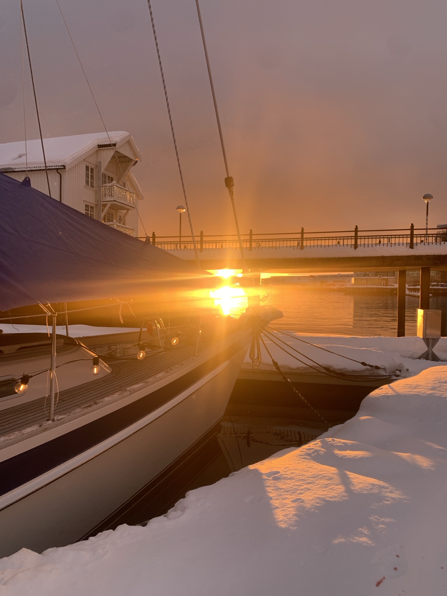
A memorable start into New Year 2026. Live screenshot taken from nearby webcam this morning.
After quite some time since our return from Tromsø, we are slowly getting out of hibernation mode. The Polar Nights will end soon and the Civil Twightlight duration will not only increase quickly but also allow the sun to show up again.
These days are hard to record. From me fighting a nasty cold, endless pouring torrential rain, hurricane graded storm, thousands of cod fish standing next to our boat, to the return of snow, etc.. Intensity and speed of change make it difficult to believe it’s real. Dark versa bright moments. An arctic glimpse.
10am, on another day. Hard to comprehend.
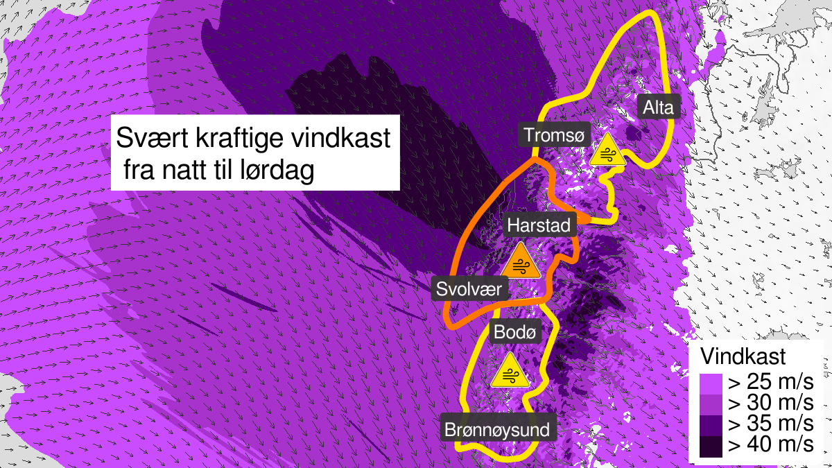
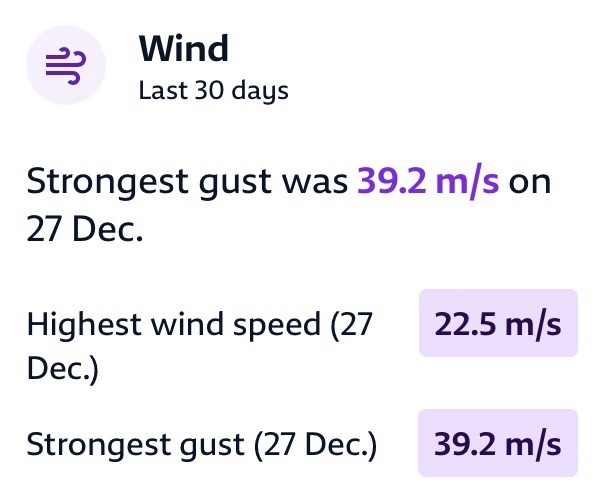
A snapshot from yr.no paired with a one off hurrican-grade gust out of nothing straight onto the beam, trying to turn The Lady upside-down, will hopefully remain a once in a lifetime experience. Gooseskin granted even days after the event, where sliding full mugs become negligible compared to a near miss burning candle. Meassured 39.1m/s of wind gust at the nearby Svolvær Airport sets a clear mark. 1500 households on the Lofoten temporarily without power, planes, ferries, busses, all cancelled, bridges closed, Hurtigruten seeking for shelter.
We were lucky, though still puzzeled.
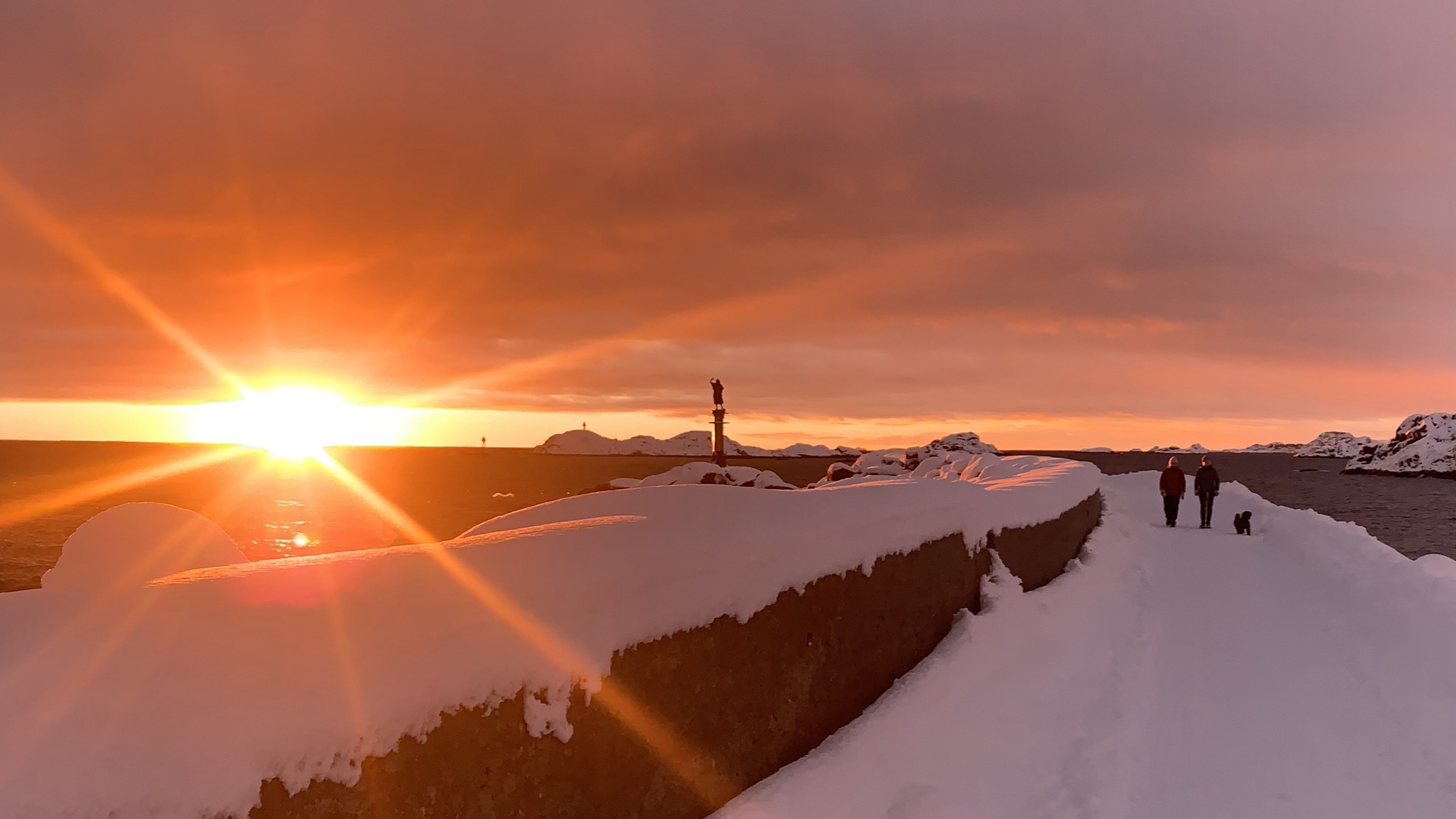
We had to complete our two-years-walk, starting with the official fireworks at 7pm in 2025 and ending around lunch time in 2026 under icy blue skies with northern winds trying in vain to get the last bit of warmth out of us. We did not party all night…
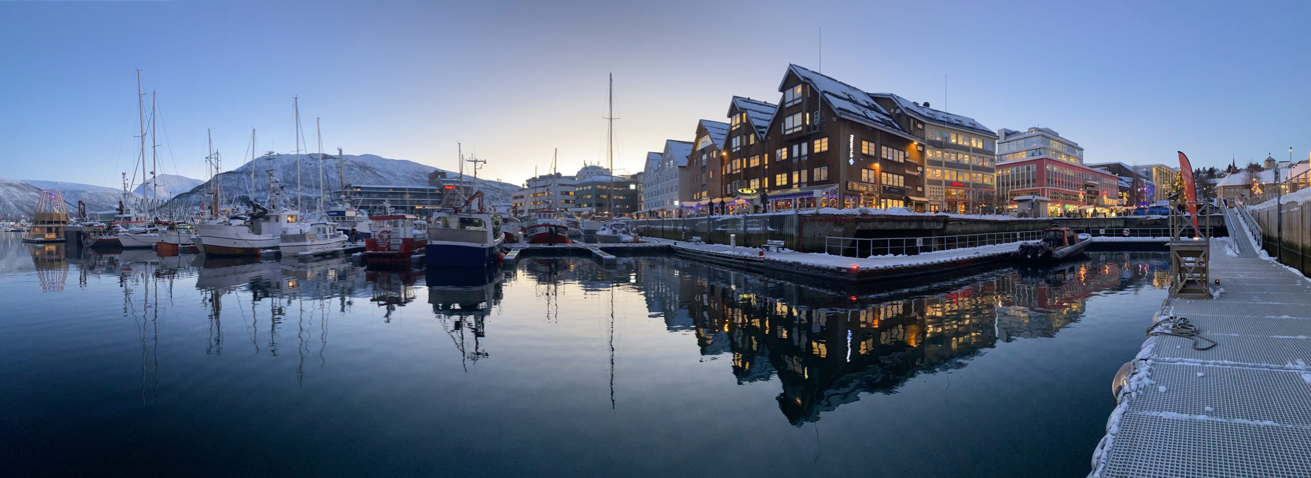
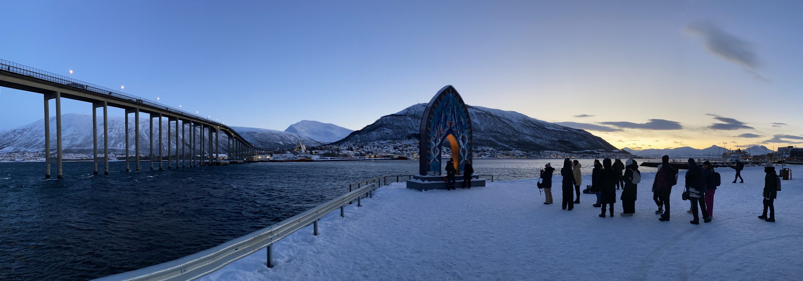
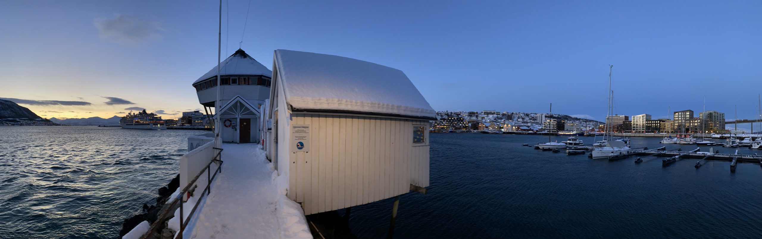
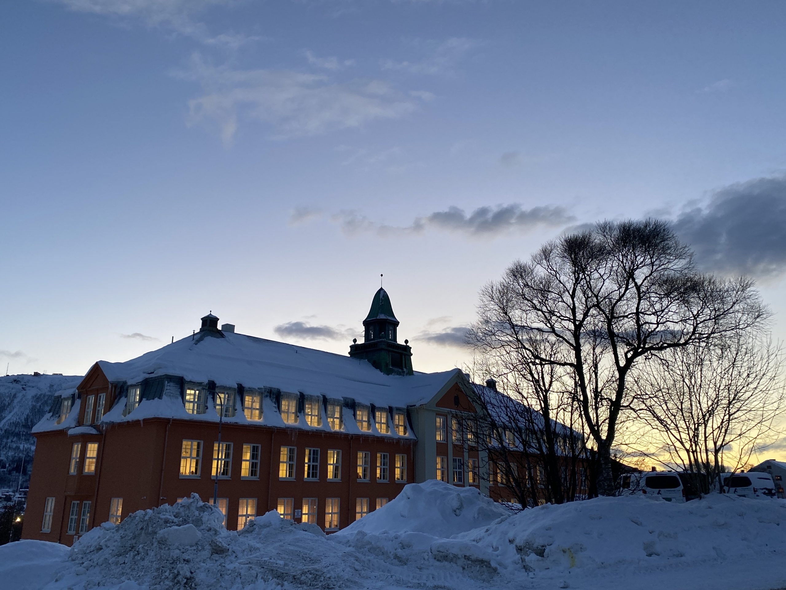
We took a week off and jumped on the Coastal Express running Bergen – Kirkenes – Bergen since 1893 to get to Tromsø. While the voyage itself was exciting, we are still puzzeled from the many impressions gathered from this fascinating city and its surroundings. The blue skies framed it nicely for us.
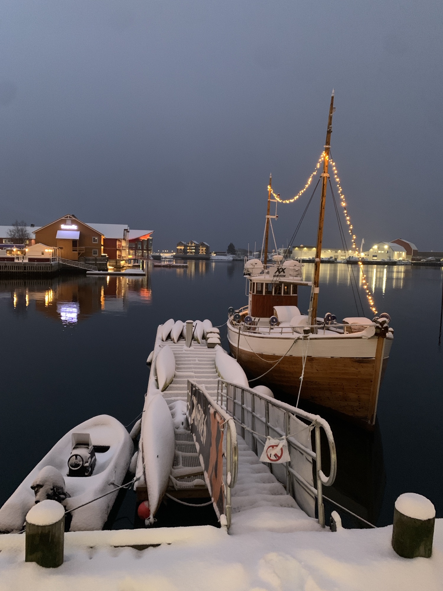
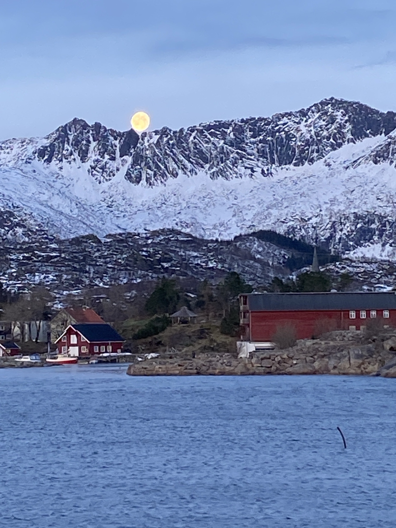
Kabelvåg from a different perspective under the moon around noon time.
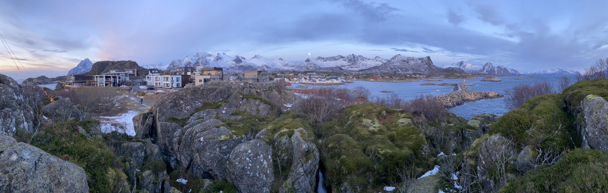
The day has come. Today was the last bike ride under the sun in 2025 unless we move to lower latitudes. The all day moon over the snow scattered Lofoten mountains was more impressive than the hiding leftovers of the sun.
Nevertheless, I deeply breathed in the last 33 minutes of daylight of the year. The dopamine produced under these biking conditions is a bit scary. Pure joy.
We will now be moving from dawn to dusk with the long nights in between.
The spirit for today’s ride was driven by a reading about the stone age caves in the middle ages estate Storvågan, both being important historical landmarks in the same place. As the public information on the caves is scarce, I ended up at the reception of the nearby Nyvågar Rorburhotel for more details. Two heads over one monitor screen, I got more clever than before but further exploration has to wait. It’s too wet.
Official daylight was limited to 61 mintues today and I did not want to miss the leftovers of the sun…
The rain took most of the snow away and left a thin laminated layer of ice on the frozen roads. Daylight was forecasted at 1 hour plus for the day with little overcast. Perfect for our long pending trip to Henningsvær. Another bus and bike trip. Susan on four wheels, me on two. The funny thing is, that the bus is not much warmer at the time leaving Svolvær, coming fresh from the bus depot.
Our handicraft is now getting produced and will be a unique combination of form and colour. Let’s see.
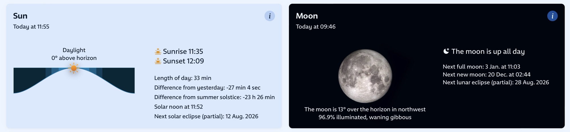
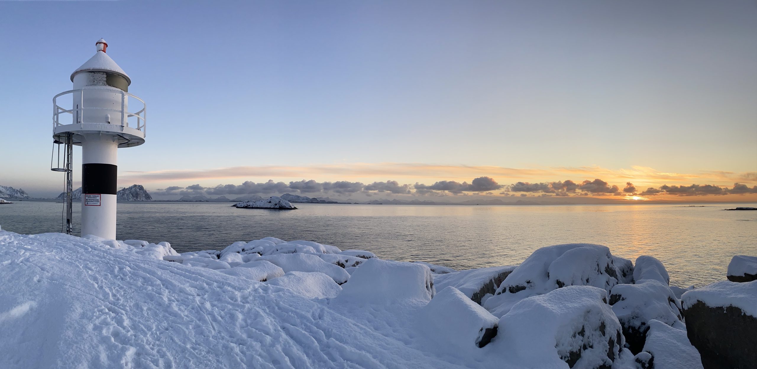
Solar noon at Kabelvåg Lighthouse. 11:50am with the sun now at 0° above the horizon (officially).
Susan discovered during a walk today, that new cod has been put up on the so far empty fish drying racks located just next door on nearby Svinøya. Although the fishing industry is not #1 anymore in terms of economy, it still plays a very significant role. Even before the reign of King Øystein (1103 to 1123), fish from Lofoten was Norway’s main source of income from export. His support is manifested in a statue overseeing Kabelvåg, which I passed by today during a short and pleasant ride in perfect winter conditions.
The terms with Bua Vågan are on a 7 days period with a condition, that you cannot borrow the same type of equipment immediately again. This will not only ensure that everybody has access to all kind of sports but perhaps also get people to try new activities, e.g. ice skating, sledge, snowboard, downhill skiing, fishing, etc. to name a few for which they can support.
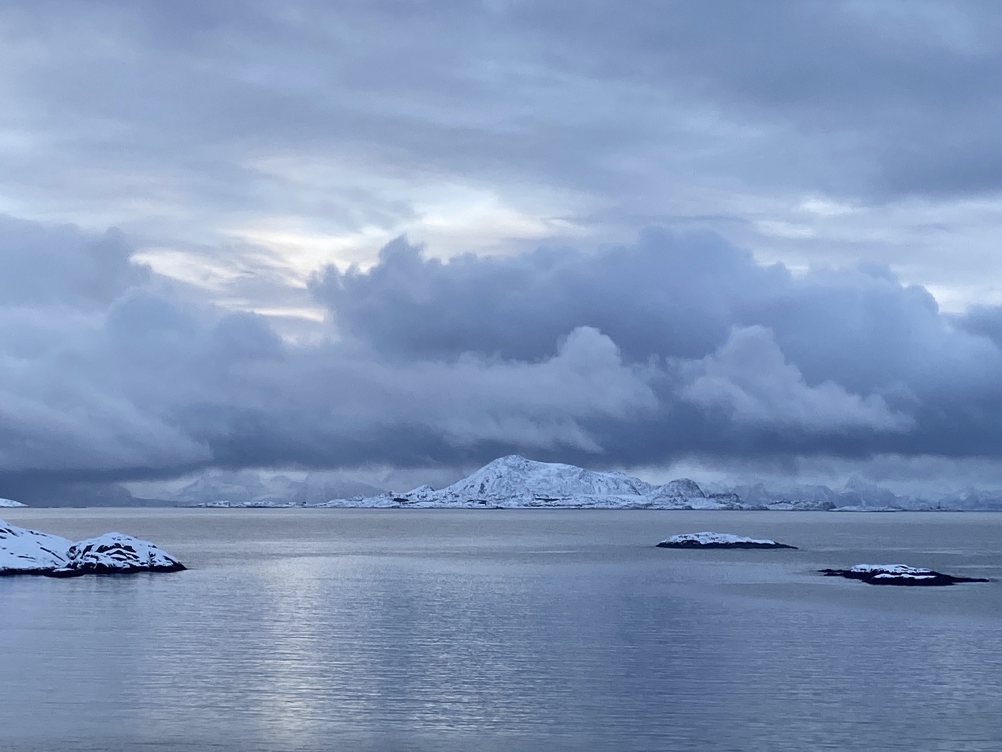
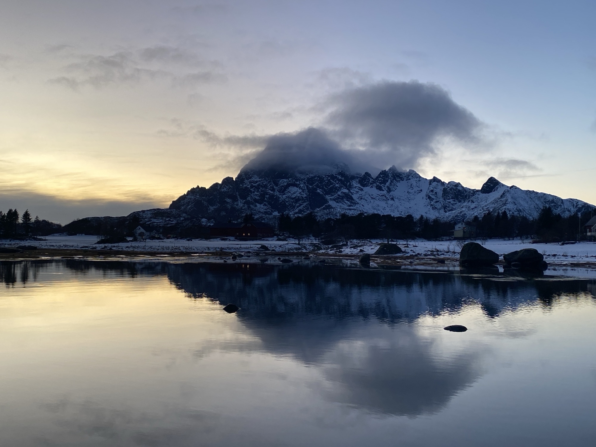
The upcoming weather was already indicated through the clouds building up along my quick ride to Kåbelvag.
With the sun at max 1° above the horizon now, it is hard to call it sunrise or sunset as both have melted together over the official 3.25h only lenght of the daylight.
There was a low band without clouds at the horizon where the sun managed to throw in plenty of arrays making it an impressive light show.
Our first sunset, dipping into the sea at a bearing of 173°, not even getting beyond South. Impressive.
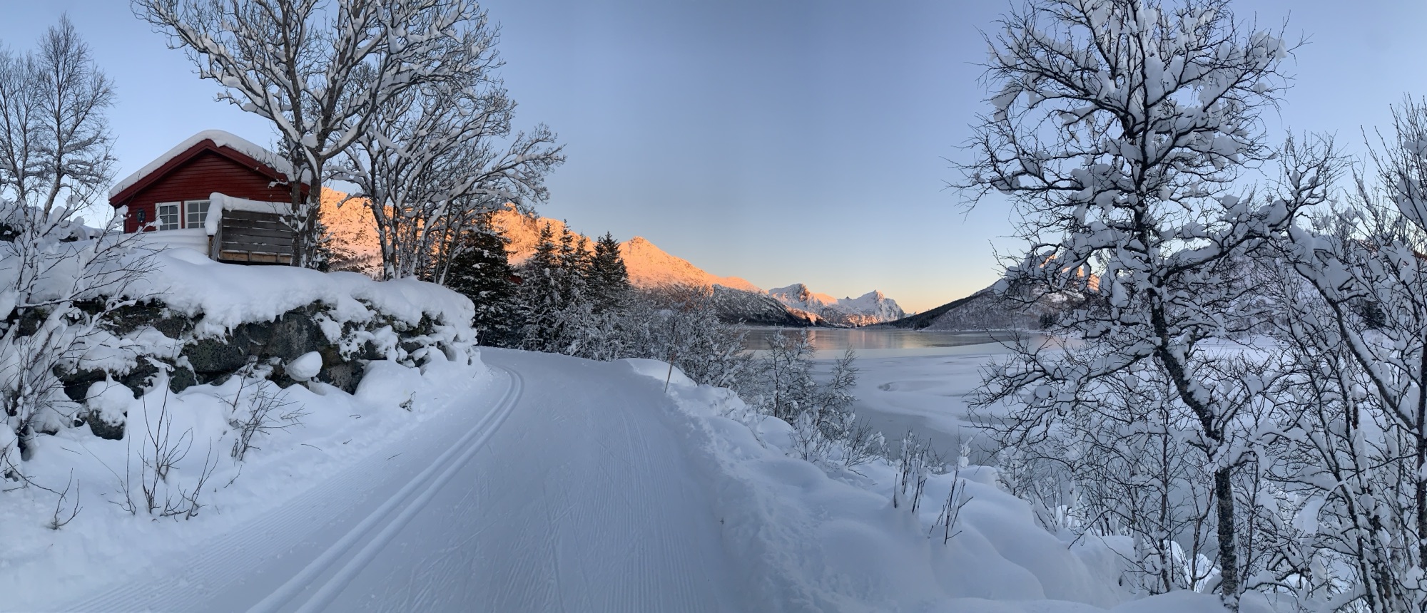
Although the cross country skiing network connects Kabelvåg and Svolvær, my preferrence was a quick bike ride to Kabelvåg over a short walk in Svolvær to get to one of the main starting points of the prepared XC track. Same time I was keen to visit the ski hut operated by Kabelvåg locals to check it’s open or still closed.
By the time now, I have figured out how best to attach ski and poles to the bike to minimize impact on riding comfort and efficency. Some more optimization work needed to reduce the time spent getting overall ready in order not to get cold before setting off.
I got on the track and enjoyed a first glide on a perfectly prepared track, which suits both styles, classic and skating. While initially a lot of my attention was needed to stay on the track, it was not possible to hover through this winterized landscape without recognizing its shear unspoiled beauty.
Having been around here many times by now, in summer and autumn, winter comes as a novum to me. Magical, thanks to the current conditions.
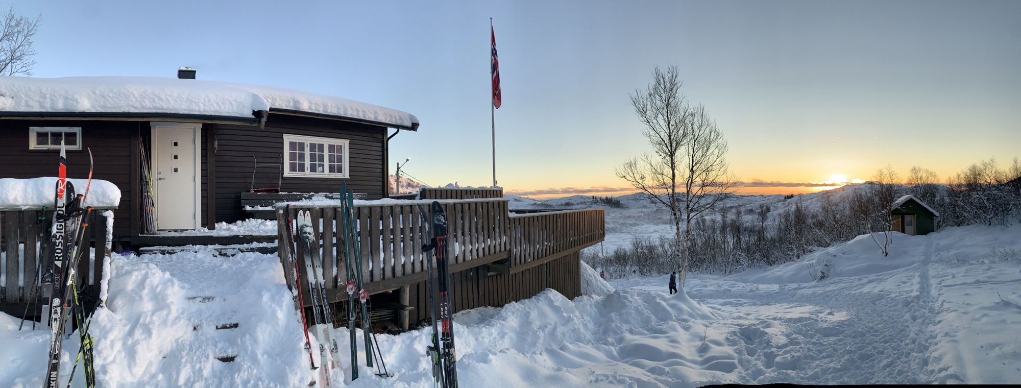
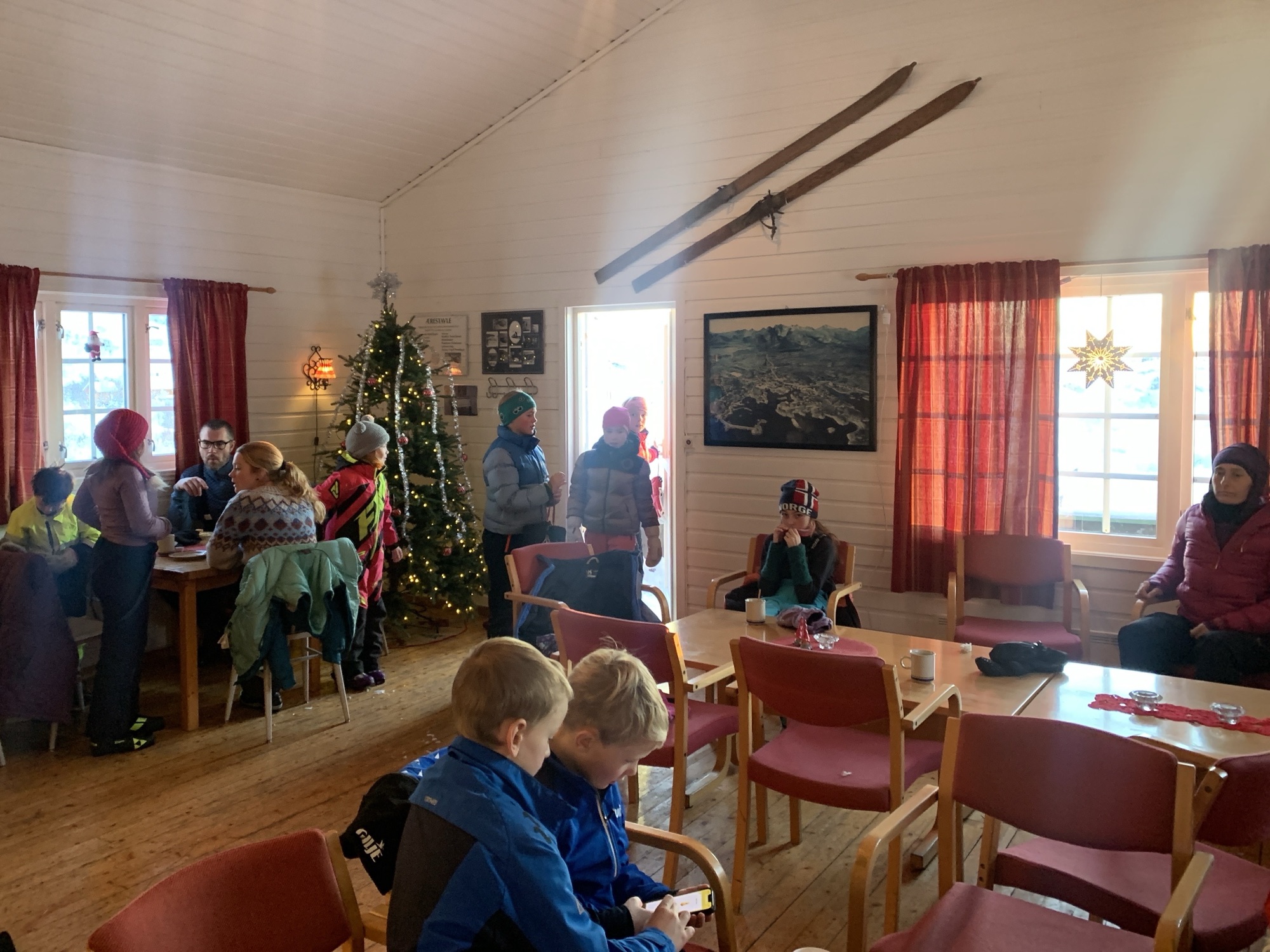
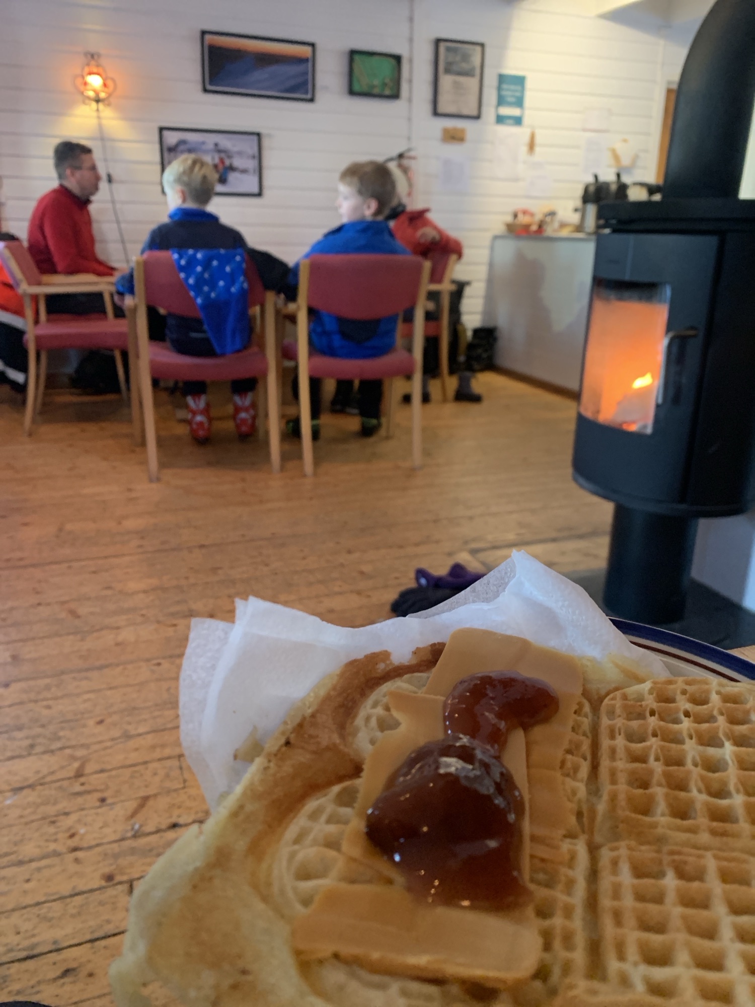
The skiing hut was open, run by the locals. Waffles, snacks and hot beverages on offer.
I could not resist a hot chocolate and a traditional Norwegian waffle with brown cheese and strawberry jam next to the fireplace. Hard to get back on the track afterwards but the daylight helps to keep the schedule. Did not plan for lights.
We hear that the amount of snow received at this time of the year is unusual. Asking locals, if it will stay, the answer is pretty unisono: maybe, maybe not.
All we know is, that a weather change will happen next week towards warmer tempertaures but if the precipitation will be rain or snow…we will find out.